Lohusalu sadam
Harju county and Tallinn · Soome laht
Suggest a video for this harbor
Add a 3–30 second video file or a YouTube link. Videos are reviewed before publication; a suitable short clip may become the page hero.
Information only This harbour does not take bookings through Mervare. Contact it directly to arrange a berth.
Run this harbour? Confirm you're authorised and start managing its listing yourself.
At a glance
- 2 mPermitted draughtpilot book
- 150 mMaximum lengthregister
- 5 mMaximum beamregister
- 2.3 mQuay depthregister
- 1. mai - 30. novemberNavigation periodregister
- 3 knkiirus ei tohi ületada 3 sõlme
- 12 m/stuule kiirusel üle 12 m/s
- 1 mlaine kõrgusel üle 1 m
- sissesõit ainult sadamapidaja loal
Services
- Shore power
- Water
- Shower
- WC
- Café
- Fuel
- Wi-Fi
- Waste
- Laundry
- Slipway
- Parking
- Bike hire
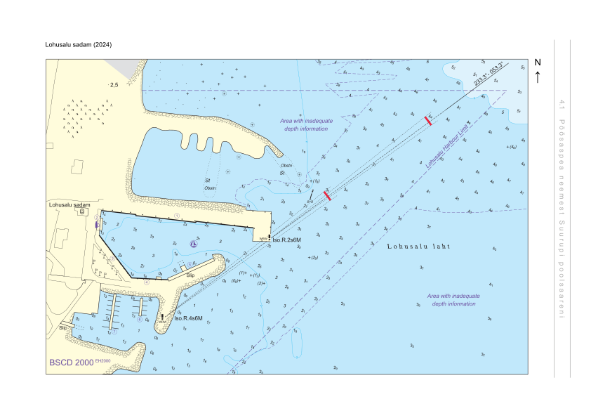
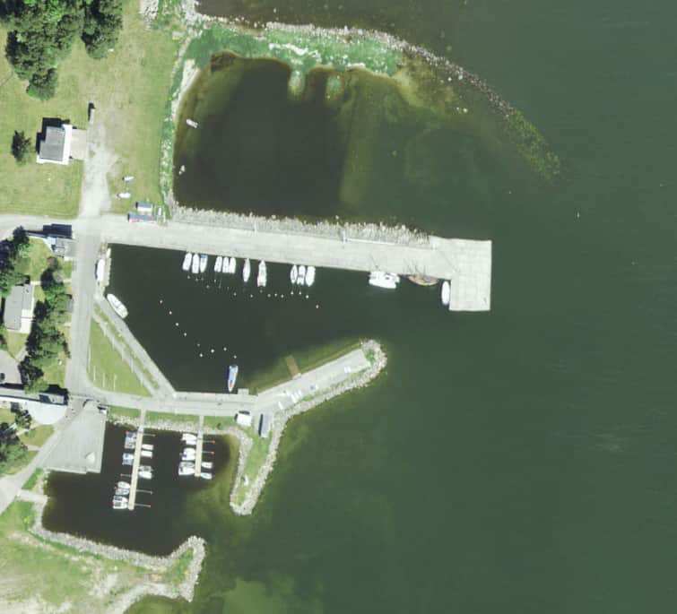
Harbour plan
Not for navigation. See every harbour on the map.
Sailing directions
Based on a published sailing directions guideLaevade üheaegsel sadamasse sisse- ja väljasõidul kehtib sadamast väljuva laeva eesõigus, v.a juhul kui tegu on hädaolukorraga. Kohalike olude tundmine vajalik. Speed limit: kiirus ei tohi ületada 3 sõlme. Entry and departure ban: tuule kiirusel üle 12 m/s; laine kõrgusel üle 1 m; sissesõit ainult sadamapidaja loal.[2]
Use together with an up-to-date nautical chart and navigational warnings.
Depths and dimensional restrictions
The maximum permitted draught is 2.0 m. Published depths alongside range from 0.2 m to 2.3 m — shallowest at quay 5, deepest at quay 3. Depths are referenced to EH2000.[2]
Depths quay by quay (7)
| quay 3 | 2.3 m |
|---|---|
| quay 1 and 4 | 1.8 m |
| quay 2 | 1.3 m |
| quay 7 | 1.1 m |
| quay 6 | 0.6 m |
| quay 5 | 0.2 m |
Sources
- Sailing directions Lootsiraamat 4.1 — Põõsaspea neemest Suurupi poolsaareni
- Sailing directions Lootsiraamat 4.1 — Põõsaspea neemest Suurupi poolsaareni
Published 12 Sept 2026 · revision 4
Data: port register, record updated 19 May 2025.
View from the ground
Webcams
We do not have a webcam for this harbour yet.
Visitor observations
Sailors' experiences, not the harbour's official information.
Practical details and harbour documents
- Address
- Harju maakond, Lääne-Harju vald, Lohusalu küla, Lohusalu tee 152, 76709
- Navigation period
- 1. mai - 30. november
- Harbour master
- VALDO TAUMANN
- Position
- 59.40281° N, 24.20358° E
- Phone
- +372 6771640
- lohusalu@lohusalu.ee
- Website
- www.lohusalu.ee
All services in the register
Veesõiduki sildumise võimaldamine · Kohvik/Restoran · Wi-Fi · Parkla · Kütus · Dušš · WC · Elekter · Slipp · Pesupesemise võimalus · Joogivesi · Jalgrattalaenutus · Prügivastuvõtt
Nearest harbours
Tallinn bay, Paldiski, Naissaar and Aegna, plus the western half of Lahemaa out to Kolga and Hara. Short legs and most services open year-round. All harbours in Harju county and Tallinn →